Vaughan’s population in 2025 is approximately 355,000 to 366,000 residents, living within a fixed land area of 272.44 square kilometres, resulting in a population density that now exceeds 1,300 people per square kilometre.
Growth in 2025 is not spread evenly across the city. It is concentrated in clearly defined urban nodes and corridors, most notably the Vaughan Metropolitan Centre, the Highway 7 corridor, and transit-adjacent redevelopment zones.
Vaughan is no longer growing outward. It is growing upward and inward, and that shift defines its demographic and spatial profile in 2025.
Population Scale and Growth Since the Last Census
The 2021 Census recorded Vaughan’s population at 323,103 residents, establishing the last fully enumerated baseline. Since then, annual municipal and regional estimates show consistent increases year over year.
By late 2024 and into 2025, Vaughan’s population is widely placed in the mid-350,000 range, with upper estimates approaching 366,000 depending on the source and reference date.
That implies a net gain of roughly 32,000 to 43,000 residents in four years, a significant increase for a city that is no longer expanding its municipal boundaries.
The growth rate is lower than Vaughan’s peak suburban expansion years in the early 2000s, but it remains strong compared with many mature Canadian cities.
| Reference year | Population | Change from prior point |
| 2016 Census | ~306,000 | — |
| 2021 Census | 323,103 | +17,000 |
| 2025 estimate | ~355,000–366,000 | +32,000 to +43,000 |
This trajectory confirms that Vaughan continues to add thousands of residents annually, even as its growth model transitions away from low-density subdivision development.
Land Area – Why Density Is Rising by Definition
Vaughan’s land area is 272.44 km², a figure that has not changed in decades. Because the municipal footprint is fixed, every additional resident increases population density. In 2021, Vaughan’s census density stood at 1,185.9 people per square kilometre.
Using a conservative 2025 midpoint population of 360,000, density rises to approximately 1,321 people per square kilometre.
| Measure | 2021 Census | 2025 estimate |
| Population | 323,103 | ~360,000 |
| Land area (km²) | 272.44 | 272.44 |
| Density (people/km²) | 1,185.9 | ~1,320 |
This increase in density is not the result of uniform crowding. It reflects localized intensification, with some neighbourhoods changing rapidly while others remain largely unchanged.
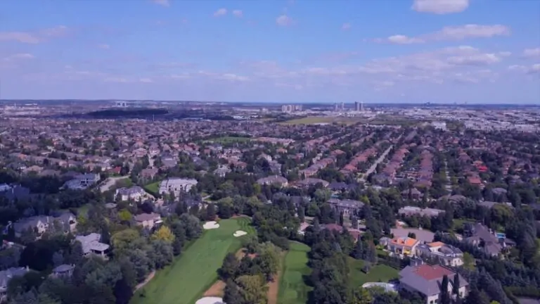
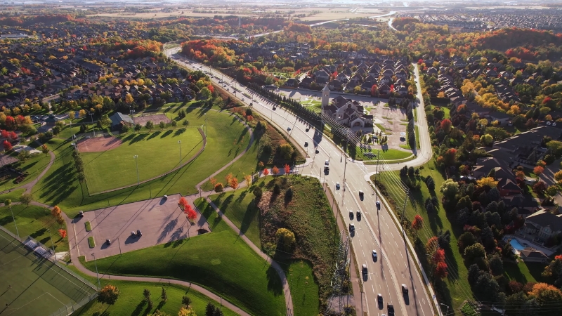
Urban Form: A City Split Between Suburb and Urban Core
Vaughan’s physical form in 2025 is defined by contrast. Large portions of the city, including much of Woodbridge and Maple, remain low-density and suburban in character. At the same time, selected districts have shifted decisively toward mid-rise and high-rise development.
This dual structure explains why citywide density remains moderate while specific growth hotspots experience densities comparable to inner-GTA urban nodes.
Vaughan’s planning framework intentionally channels growth into these areas to protect stable neighbourhoods while meeting provincial intensification targets.
Growth Hotspot 1: Vaughan Metropolitan Centre (VMC)
View this post on Instagram
The Vaughan Metropolitan Centre is the single most important population and density driver in the city. Anchored by the subway terminus on the Toronto-York Spadina extension, the VMC was planned explicitly as a high-density, mixed-use downtown.
By 2025, the VMC will contain:
- A concentration of residential towers, many exceeding 40 storeys
- A growing employment base in office, institutional, and service sectors
- Transit connectivity that supports car-optional living
Population growth here is vertical and rapid. A relatively small land area absorbs a disproportionate share of Vaughan’s net population increase, pushing local densities far beyond the citywide average.
Growth Hotspot 2: Highway 7 Corridor
The Highway 7 corridor functions as Vaughan’s secondary growth spine. Running east–west through the city, it has transitioned from low-rise commercial uses to a mix of residential, office, and retail development.
Growth along Highway 7 is characterized by:
- Mid-rise residential buildings
- Mixed-use podium developments
- Gradual parcel-by-parcel redevelopment rather than megaprojects
While densities here are lower than in the VMC, the corridor contributes steadily to population growth and reinforces Vaughan’s shift toward transit-oriented development.
Growth Hotspot 3: Transit-Adjacent Infill and Secondary Nodes
Beyond the two primary hotspots, Vaughan’s growth also appears in secondary nodes near major arterial roads and transit routes. These areas typically see:
- Townhouse and mid-rise infill
- Redevelopment of aging commercial plazas
- Incremental increases in residential density
These projects do not dominate headlines, but collectively they account for a meaningful share of annual population gains.
Annual Growth Rate and What It Implies
Recent estimates suggest Vaughan’s population has been growing at approximately 1.1–1.3 percent per year, translating to 3,500 to 4,500 new residents annually.
This rate is slower than Vaughan’s historic suburban boom but remains robust for a city approaching 400,000 residents.
| Indicator | Approximate value |
| Annual growth rate | ~1.2% |
| Annual population increase | ~4,000 |
| Growth type | Intensification-driven |
This growth pattern is more stable and predictable than past expansion phases, but it places sustained pressure on infrastructure, housing supply, and transit capacity in growth areas.
Vaughan in The GTA Context
Vaughan’s density and land use position it between Toronto’s urban core and the outer suburban municipalities.
| City | Population (2025 est.) | Land area (km²) | Density (people/km²) |
| Toronto | ~3.1 million | ~630 | ~4,900 |
| Mississauga | ~790,000 | ~289 | ~2,700 |
| Vaughan | ~360,000 | 272.44 | ~1,320 |
| Markham | ~365,000 | ~210 | ~1,700 |
Vaughan’s density is rising faster than its land consumption, confirming its shift from suburban growth to urban intensification.
Long-Term Planning Signals Beyond 2025
@katiesteinfeld Can anyone else relate?! We ❤️ living jn Vaughan for all it has to offer 🙌 #liveinvaughan #vaughan #vaughanontario #liveinvaughan ♬ original sound – Katie Steinfeld
Municipal planning documents extending to 2051 anticipate Vaughan adding more than 200,000 additional residents over the long term.
These projections assume continued concentration of growth in designated intensification areas, not widespread low-density expansion.
The implication for 2025 is clear: current growth hotspots are not temporary. They are the structural foundation of Vaughan’s future urban form.
Bottom Line
Vaughan in 2025 is a city of roughly 355,000 to 366,000 people living within 272.44 km², with a population density now exceeding 1,300 people per square kilometre.
Growth is not evenly distributed. It is concentrated in the Vaughan Metropolitan Centre, along Highway 7, and in transit-adjacent redevelopment zones.
The city’s expansion phase is over. What defines Vaughan now is how effectively it manages density, infrastructure demand, and land use within a fixed geographic footprint.